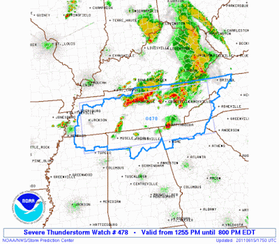
Severe thunderstorms are possible within the yellow shaded areas on the above image this afternoon & evening. A Severe Thunderstorm Watch is already in effect for much of Tennessee and adjacent portions of Mississippi, Alabama and Georgia, until 7pm CDT/8pm EDT.
Strong to severe thunderstorms are ongoing across portions of Tennessee, with large hail and damaging winds the primary threats as they continue to move and/or develop Eastward and gradually Southward this afternoon. Very heavy rainfall and dangerous lightning can also be expected with this activity.
Additional thunderstorm development is likely to take place Westward along a weak surface frontal boundary across portions of Arkansas later this afternoon & evening. Large hail & damaging winds would be the primary threats with this activity.
There is a conditional risk that a severe storm or two could form even further West along the decaying frontal boundary, near the Red River border between Texas and Oklahoma. A strong capping inversion is in place in this region and along with the weakening front it will be harder for storms to be able to form in this area today compared to yesterday.... however any isolated storm that does form would likely be severe, with large hail & damaging winds the primary threats.
Additional development is expected to take place later this afternoon across Florida as the seabreeze interacts with an increasingly unstable low-level atmosphere across the region. Damaging winds and hail will be the primary threats with this activity as well.


No comments:
Post a Comment