On Weather & Climate Through the Eyes of Mark Vogan
Winter’s coldest spell to sprinkle -25C magic upon Moscow
RT
ARCTIC AIR POOLS CHANGE POSITION THROUGH THIS WEEKEND!
MAJOR ARCTIC OUTBREAK DIVES INTO SCANDINAVIA & EASTERN EUROPE, CORE SETTLING OVER RUSSIAN CAPITAL AS USA ENJOYS REPREIVE FROM HISTORIC COLDWAVE
IT ALL STARTED OVER WESTERN EUROPE THEN NORTH AMERICA AND NOW EASTERN EUROPE, ALL AREAS ARE SEEING TOUGH RECORD-BREAKING WINTER CONDITIONS THIS SEASON, AT DIFFERENT STAGES OF THE WINTER
By Mark Vogan
1) WESTERN/NORTHWESTERN EUROPE'S COLDWAVE
MONTH-LONG ARCTIC BLAST WHICH CREATED THE COLDEST DECMEMBER IN OVER 150 YEARS IN BRITAIN!
November 25 through New Year
The UK, Ireland and eastwards towards Germany endured it's worst period of winter in living memory between November 25th and New Year and this cold pattern remained into the first 10 days of January 2011 but in a waning fashion.
Heavy and persistent snows blanketed all corners of the UK and Ireland as well as much of central and northern Europe. After a few weeks of heavy snow which built up to depths of 6-14 inches, then it was all about the Hound of the Arctic running rampant across this huge snowcovered area.
Persistency of this deep cold in a typically mild region meant locals struggled and so too did government agencies in keeping roadways open as snow and ice became a daily struggle. From December 10 till Christmas, days became unusually cold as towns and cities remained below freezing, rural areas commonly under -10C and this was following a solid couple of weeks of heavy, persistent snows in which a seemingly never ending easterly flow off the North Sea onto eastern Scotland and the Northumberland, Yorkshore coast meant the snows kept piling up. Aberdeen, Edinburgh and Newcastle where worst effected out of any major UK city with Edinburgh piling up 30+ inches, the most since 1963 and the worst nationwide snow since 1965. Once skies cleared out and higher pressure of Scandinavian origin pushed down across the UK and Ireland as well as France, Germany and Poland, more or less every night saw clear, stary skies, mostly light winds and readings even in urban heated areas dipped to -10C or lower. At the peak of the cold, these were the temperatures achieved within the cities of Britain and western Europe.
CITY COLDEST HIGH/LOW AVERAGE HIGH/LOW
Glasgow -7.8C/-13.8C 6C/2C
Manchester -5.6C/-13.9C 6C/2C
Birmingham -4.0C/-15.0C 6C/2C
London (HEATHROW) -0.7C/-9.4C 6C/2C
Paris -1.1C/-6.1C 6C/1C
Rotterdam -3.4C/-11.2C 6C/1C
Berlin -7.1C/-14.1C 2C/-1C
Warsaw -11.0c/-11.0C 0C/-4C
STATS COURTESY OF ACCUWEATHER PRO
2) AMERICAN COLDWAVE
FROM JUST AFTER NEW YEAR IT WAS ALL DOWNHILL TILL FEBRUARY 9 WITH COLD CORE LEAVING EUROPE AND CROSSING THE POLE, ENERGIZING THE CANADIAN ARCTIC RESERVOIR WHICH PLUNGED SOUTHWARDS WITH TIME , CREATING A SUPER FINALE OVER NEW MEXICO, OKLAHOMA TO ARKANSAS!
January 5-10 through February 9-10
After a chilly to cold December for much of the USA and very cold Southeast once the cold departed Europe, it was all systems go for the North American continent as Arctic air shifted east into East Asia and this was when the coldest temperature brutalised Siberia's coldest places. The well known "pole of cold" village of Oymyakon, tucked away in a frozen lost valley far up into the northeast corner of Asian Siberia temperatures haven't been seen freezing since early October and to this day remain solidly in the bitter depths of winter with daytime maximums remaining for the most part under -40C. During the transitionary period in which the harsh cold left Europe, Siberia deepended it's cold core before a crosspolar jet shifted some of this super cold across to Canada in which the jet never stopped until it delivered severe cold down into the heart of the USA. During this time, Oymyakon registered a high of -56C, that's -69F, the low two nights later fell to the lowest levels here since January 2003 with a reading of -61.4C or -78F. This reading was just shy of the last time it was this cold, -61.4C or -79F. Most winter's see a -60C interestingly fewer sees -61C. That 1-degree difference certainly stands out. The reason, once the air gets this cold, it's extremely tough to get even colder and it appears that the general maximum level in which the air can get cold is right around -60C and only every so many years, you'll see even lower. The all-time record is -67.7C or -90F.
It seems that the coldest temps in Siberia were achieved in between the time Europe lost it's cold and North America grew markedly colder with the crosspolar delivery. Of course the coldest air flow past this region when a crosspolar flow takes charge!
After a long 5 week sustained period of harsh cold which focused over the south-central Prairies of Canada and south into the northern and central Plains of the USA, the later of this harsh period (last 2 weeks) of peristent cold of saw the worst cold and greatest deperatures from normal span from Denver southwards into New Mexico where multiple daily and alltime records fell and this core of cold progressed south and east into the heart of Texas, Oklahoma and Kansas. What was seen was one of the greatest ever Arctic outbreaks to ever hit the Southern Plains which came is two waves, driving down on the rear of two huge snowstorms. The perfection of the atmospheric setup couldn't have been more impressive as 2-4 inches fell over Texas (locally higher amounts) and 8-25" fell over Oklahoma and Kansas as well as Arkansas and when those storms pushed out, we saw the Arctic air flow right across this reflective blanket of fresh, fluffy, deep snow and allowing very little modification despite this pool of air being so far south, producing highs even in Texas no better than 5-10 degrees and night's that despite wind blowing, plummeted to between 5 and 13 below zero on the Texas Panhandle with windchills as low as 30 to 40 below zero. The worst of the cold, about 3-4 weeks ago centered over southern Canada and across the US border into Montana, Colorado, North Dakota, Minnesota, Wisconsin and Michigan where highs remained below zero, windhills between 45 and 60 below zero and the coldest temps were achieved at Glasgow, MT which registered one night at 37 below zero and wind chills in the -50s. The actual lowest reading was found at International Fallas, MN on the Canada border with Fort Frances, Ontario where the low fell to 46 below zero, the 5th coldest ever reading here and coldest since 1968! Denver, CO saw it's first subzero daytime high in some 15 to 20 years and temps dipping to 18 below zero at night. Once a Pacific storm system bl;asted across the Rockies and out onto the Southern Plains, this opened the door for the Arctioc air to spill further south and towards the Gulf.
Wave 1 produced around -20 lows in western Nebraska, as cold as -19 at Nowata, Oklahoma and even -13 at Dalhart, Texas with single digits pushing to Lubbock and Midland. New Mexico was pretty much ALL below zero with all-time records falling left right and center. At Santa Fe, it got to -18, Angel Fire hit -36. During wave 2, the core of coldest air sat over the Kansas-Oklahoma state line and the the north Kansas, Nebraska failed in some spoits to get above zero and nights dipped to in and around 20 below. SE Kansas got to 23 below at Parsons, KS whilst it hit 28 below at Bartlesville and 31 below at Nowata. Those two lows surpass Oklahoma's all-time record low of 27 below. Amarillo saw 6 below zero
Up in the high country of Colorado and during the secondary wave of super cold air, the night previous to the Oklahoma record being broken, Antero Reservoir, CO endured a low of 45 below zero.
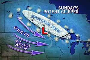
MOSCOW LOOKS SET TO ENDURE WORST WEEK OF WINTER WITH HIGH'S STRUGGLE TO WARM ABOVE -20C AND NIGHTS MAY TAKE RUN AT -30C
Now (Feb 11) and warmth is spreading all across the heartland of the US and what we're seeing is a return to frigid air back across Europe, only this time it's eastern Europe with a focus appearing to settle into Moscow. It's been very cold there with highs in the -10 to -12C range and nights around -18C,. however this is with cloud and heavy snow falling, it appears high pressure is set to drop in, clear skies out and with all the fresh snow, it's going to get frigid! Highs into this week look set to remain at -18C or lower and night's may take a run at -30C by late this week. These numbers, even into the mid minus 20s C should surpass the coldest reading of this winter so far which occured right back on Dec 1st when it hit -23C or -10F. In fact we may see most night's get lower than the seasonal minimum so far, the question is can it hit the -30C that was reached back in January 2006 which was one of the harshest winter's here in living memory.
This is occuring at the same time Texas, Oklahoma and even up into Kansas and Nebraska is in for a late season heatwave with 70s spreading throughout the exact areas that were coldest last week!
TODAY'S WEATHER ACROSS AMERICA
From AccuWeather
Milder Air To Tease The Northeast
By Kristina Pydynowski, Senior Meteorologist
Natural Gas Shortages, Don't Be Left Out In The Cold
By Tiffany Getz, AccuWeather.com Staff Writer
Strong Winds From Northern Rockies to Mid-Atlantic
By Kristina Pydynowski, Senior Meteorologist
Earthquake? No... Frost Quake
By Gina Cherundolo, AccuWeather.com Staff Writer
VAGARIES OF THE WEATHER
INDIA & SUB-CONTINENTAL ASIA WEATHER
BY RAJESH KAPADIA
F2 on Schedule ! Heavy precipitation amounts in Pakistan, Saturday thru Sunday morning. From 53 amonst the highest at Pattan, and some other stations reading around 50 mms in Balochistan, to- 31 mms at Quetta, and 25 mms in Norkundi. Sevearal palces in Balochistan and upper Sindh are getting good rains.
Karachi, with overcast skies and very strong S breeze, is waiting for its rainfall today.
F2 has moved into India, and should pick up strength today, Sunday.
The indications mentioned in previous discussions in Vagaries of clouding and light precipitation running thru Kutch thru Rajasthan into NW India is also happening. Expecting light showers in S.Rajasthan and Kutch.
Syatem moving into Nepal next Tuesday/Wednesday, and should cover the entire country in 2 days. I know I am repeating this, but Kathmandu should get about 10 mms accmulated precipitation in 2 days.
Mumbai will as indicated on Friday get the clouds over its skies from Tuesday night/Wednesday, with some very light precipitation in some areas.
Not much precipitation expected in the South till Wednesday,and till then, some monitoring of an UAC will be needed.
Akshay, I think the days are high today, but will drop to some extent,in Central regions including Nagpur from Monday/Tuesday, due to W.D. effect.
Click here to see the best personalised India, Sub-Continental and International Weather whom I'm always proud to be in partnership with!
THE EXTREMES OF THE DAY
TODAY'S US EXTREMES
COURTESY OF ACCUWEATHER
HIGH: 85 degrees at Anaheim, CA
LOW: -21 degrees at Butternut, WI
TODAY'S UK EXTREMES
COURTESY OF THE MET OFFICE
HIGH: 54 degrees (12C) at Monks Wood (Cambridgeshire)
COLD HIGH: 38 degrees (3.4C) at Loch Glascarnoch (Highland)
LOW: 26 degrees (-3.3C) at Castlederg (Co Tyrone)
TODAY'S EXTREMES HERE AT MY HOUSE
HIGH: 50 degrees
LOW: 38 degrees
Thanks for reading.
-Mark


No comments:
Post a Comment